Škrlatica - škrlatna lepotica Juijskih Alp, Škrlatica, queen of Julian Alps

Škrlatica,
the queen of the Julian Alps

    Škrlatica, the queen of the Julian Alps

    Škrlatica is a 2,740 m high mountain in the Julian Alps. It is the second highest mountain in Slovenia and the third highest in the Julian Alps. Its steep rock walls attract mountain lovers. The trail to the top is quite challenging and suitable for hikers who are fit and experienced.
    The most beautiful views of Škrlatica’s sheer north face, extending into the Velika Dnina cirque (1,900 m), are from the north-west, from the trail leading to the Vršič Pass. The mountain is especially beautiful at sunset, when its walls turn purple. That is how Škrlatica got its name.

    Škrlatica is a peak in the Julian Alps, rising majestically between the Vrata and Velika Pišnica valleys. In the north-east, Škrlatica is linked to the Martuljek mountain chain via Visoki Rokav (2,664 m). The south-western ridge of Škrlatica descends towards the Kriška stena wall. There are several trails that reach the top. From the top, there are superb views of the surrounding mountains, valleys, and even the Adriatic Sea. The views from Škrlatica surpass even those of Slovenia’s highest peak, Triglav (2,864 m).

    Škrlatica, queen of Julian ALps - on the top - Uroš Ledinek

    On the top of Škrlatica 2740m
    Poto: Uroš Ledinek

    The locals used to call Škrlatica Suhi plaz (“Dry Avalanche”). It was named after the characteristic scree slope below the Rokavi ridge.

    Starting points for climbing Škrlatica


    You can reach the top from three starting points. The shortest trail starts in the Vrata Valley at 1,015 m above sea level.


    Starting point 1: Aljažev Dom, Vrata Valley (1,015 m)

    From the Vrata Valley, the trail first takes you through a forest, with steep climbs in some places. The trail continues over rocky terrain through low mountain brush. After about one hour, you will reach a grassy slope offering great views of the nearby peaks and Triglav. On the slopes of Stenar you will pass Bivouac IV at Rušje, which lies below Dolkova špica at 1,980 m above sea level. From the bivouac, you will enjoy beautiful views of Stenar, Križ and part of Dolkova špica. The bivouac at Rušje is open throughout the year and can accommodate up to eight people.

    Škrlatica, queen of Julian ALps - bivouac IV - Uroš Ledinek

    Bivouac IV at Rušje
    Poto: Uroš Ledinek

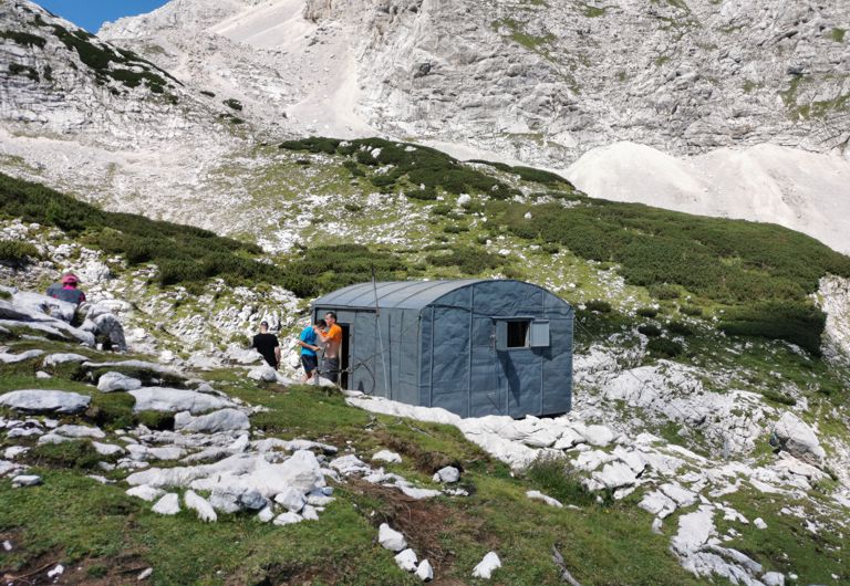
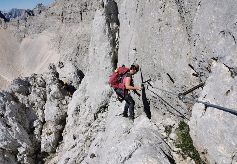
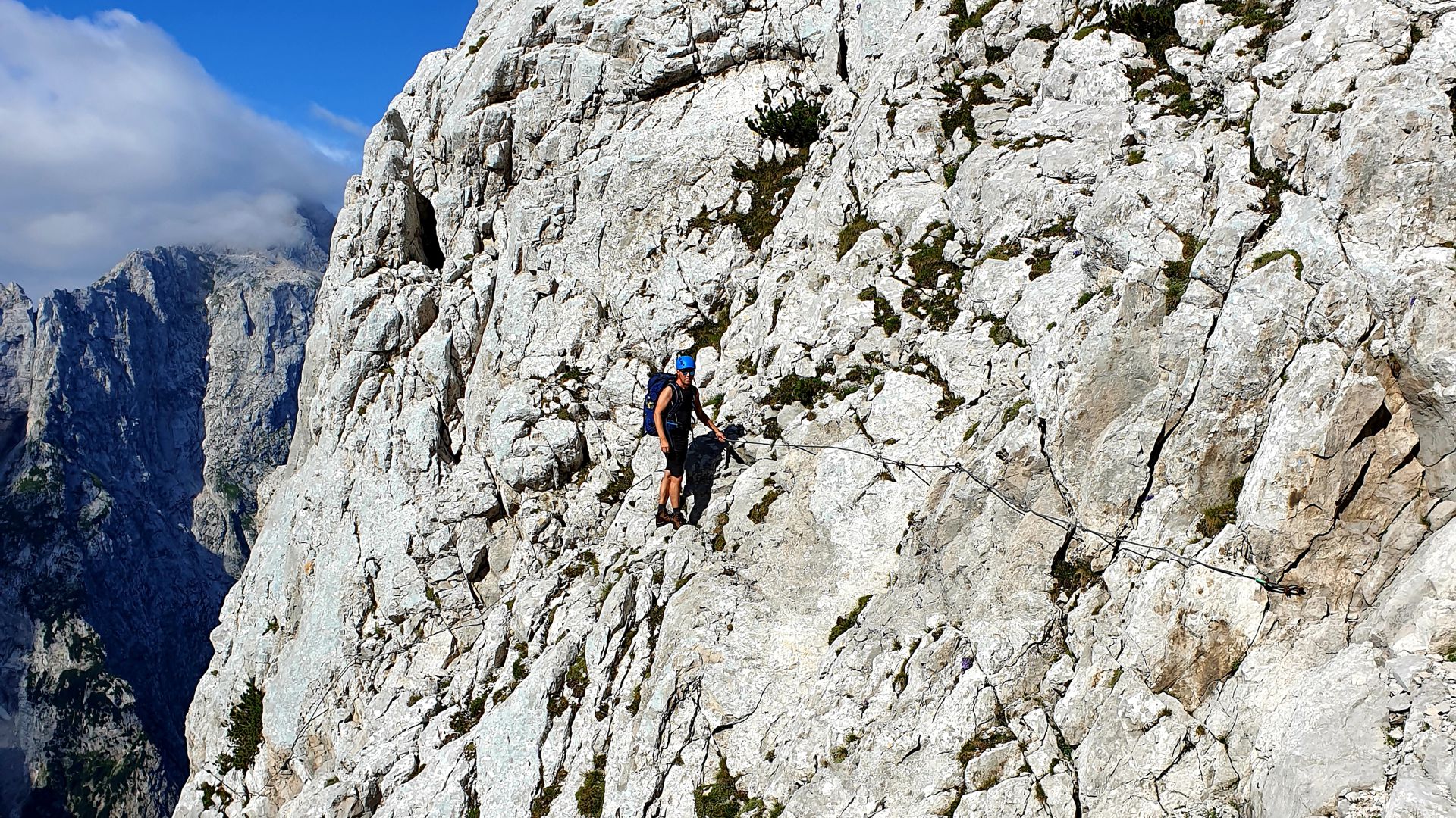
    From the bivouac, the trail will take you across scree, grassy slopes and pastures, and soon you will reach 2,000 m above sea level. The trail will then traverse the south-eastern slope of Dolkova špica (2,591 m) standing between Stenar and Škrlatica. At the end of the slope, the trail makes a slight descent into a basin, where snow remains until late summer. You will continue traversing gentle slopes, and, after a good half hour of walking, start the climb towards the Zadnji Dolek cirque. As you cross the scree slope, you will reach the most challenging part of the trail, the entry to the rock wall. Before starting the climb, put away your hiking poles and put on your helmet. Climbing gloves are also recommended. You will need some climbing skills and strength in your arms to deal with this part. The climbing route is well-secured with steel cables, pins and rungs. It includes a somewhat challenging traverse of a smooth rock ledge, secured with pins.  The steep climb is followed by easier scrambling across sharp, scattered rocks before exiting the climbing part of the trail. Along the way, there are some breathtaking views of the sheer rock faces and nearby peaks. Make sure you don’t miss Škrlatica’s natural rock window while climbing up to the ridge. Many only notice it while descending. As you come out on the ridge, the trail levels up and turns to the east. The eastern side of Škrlatica offers great views of the most beautiful peaks of the Julian Alps, with Triglav in the palm of your hand. From here, you can see the cirque called V Kotlu, lying under the sharp Rokavi ridge, the Triglav north wall, the sharp “teeth” of the Martuljek mountains chain and much more.

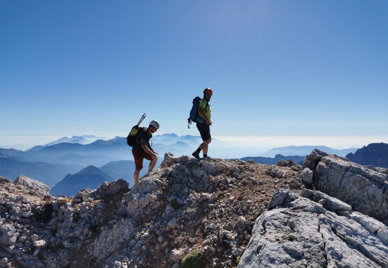
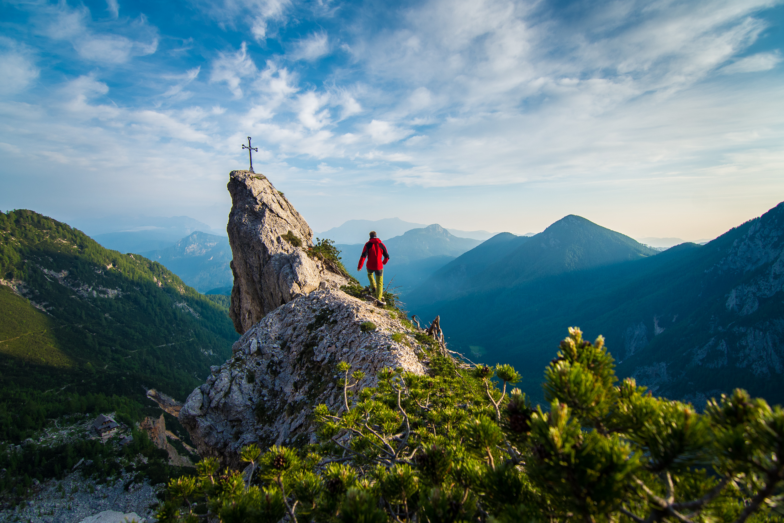
    When you see a large cross, you have reached the top of the second highest mountain in Slovenia.


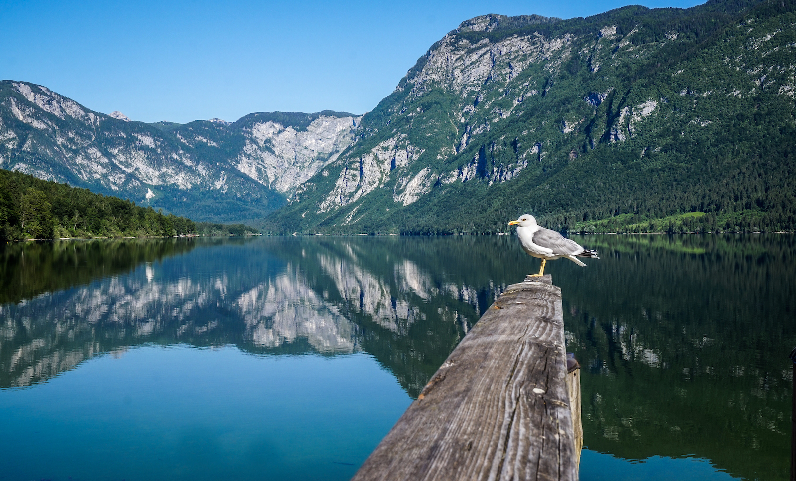
    There are spectacular views from the top of almost all the major peaks of the Julian Alps (Triglav, Špik, Martuljške Ponce, Oltarji, Rokavi, Dolkova špica, Cmir, Prisojnik, Razor, Mangart, Jalovec and many others).


    Trail difficulty

    It will take you about 5 hours to reach the top of Škrlatica from the Vrata Valley, and you will gain 1,725 m of elevation. This trail is quite demanding, mainly due to its length. The trail is moderately difficult in terms of technique. It is well-maintained and signposted.

    Škrlatica, queen of the Julian Alps - climbing on to the top - Uroš Ledinek

    Climbing wall on Škrlatica
    Poto: Uroš Ledinek

    Starting point 2: from Zadnjica (690 m)


    The trail from Planina Zadnjica starts in the Trenta Valley. From there, the trail quickly ascends above the valley of Beli Potok. You will traverse several steep slopes with a high risk of falling rocks, so wearing a helmet is a good idea. Next, that trail crosses the Veliki Presek gully, where you will run into the first steel cable on the way. You will continue through a forest and across several gullies that are somewhat exposed. Gradually, the trail will bring you above the tree line and you will get the first views of the Julian Alps and Triglav National Park. A little higher up you will reach steep scree slopes with great views of the Trenta Valley. Further on, you will come to a turning, from where you can make a short detour to the Lower Kriško Lake, if you can spare the time. It is a beautiful Alpine lake nestled amid steep mountain walls. You will continue towards the mountain lodge Pogačnikov Dom na Kriških Podih. Along the way, you can admire peaks such as Planja (2,453 m), Razor (2,601 m) and Pihavec (2,419 m).

    Škrlatica, queen of the Julian Alps - on the way to the top - Uroš Ledinek

    Along the ridge of Škrlatica
    Poto: Uroš Ledinek

    From Pogačnikov Dom, the trail continues in the direction of Razor and Križ (2,410 m). You will ascend steeply through the karst plateau of the Kriški Podi. You will see the Lower Kriško Lake, and a little higher the Upper Kriško Lake. The trail then traverses the steep slope of Kriški Rob and reaches the top of Kriška Stena (2,289 m), from where you will continue in the direction of Škrlatica. Next, you will traverse the slopes of Gubno (2,403 m) and Dovški Gamsovec (2,440 m), then continue towards Rdeča Škrbina (2,500 m). The trail will lead you across an exposed section of scree, where caution is advised. There is a high risk of slipping here, so tread carefully. After a few minutes, you will reach the Zadnji Dolek cirque and join the trail from the Vrata Valley. You will continue towards the south-western wall of Škrlatica and reach the top via the climbing route.


    Trail difficulty

    It will take you about eight hours to reach the top of Škrlatica from Planina Zadnjica, and you will gain 2,400 m of elevation. The hike is very demanding and long, so it is advisable to split it over two days. The trail is well-marked and secured with steel cables in exposed sections. The climbing section of the trail is likewise secured with steel cables, pins and rungs.

    Škrlatica was first conquered in 1880. The first to reach the summit were Dr Julius Kugy and two guides from Trenta, Andrej Komac and Matija Kravanja. Kugy was also the first to climb the north wall (in 1896).

    Always on the right trail

    Use the interactive map to find your perfect outdoor experience. Always in the right place at the right time on the right path.

    Starting point 3: Russian Cross (1,000 m), Vršič


    Coming from Kranjska Gora, Škrlatica can be reached from the road to the Vršič Pass. The trail starts at the third hairpin turn of the Vršič Pass road. You will first climb through the forest and onto broad grassy slopes, then cross the Suha Pišnica riverbed and reach the mountain pasture V Klinu. From there, you will continue to the Krnica Lodge. Further on, the trail ascends steeply and soon reaches above the tree line at the foot of the Kriška Stena. Some climbing is required here, so remember to bring a helmet and climbing gloves. Follow the trail markings and signs. Continue in the direction of Križ and Škrlatica. Along the way, you will be able to admire Mala Martuljška Ponca (2,501 m) and Velika Martuljška Ponca (2,602 m). Next, you will continue towards Rdeča Škrbina (2,500 m) and follow the trail across scree with several exposed sections. Be very cautious, as there is a high risk of slipping here. When you reach the Zadnji Dolek cirque, join the trail from the Vrata Valley. You will continue towards the south-western wall of Škrlatica and reach the top via the protected climbing route.


    Trail difficulty

    The hike from the Vršič Pass road to Škrlatica is quite long and demanding. The hike takes a little over seven hours, so we recommend that you split it over two days. The trail is very demanding but well-marked. In some places, however, the markings are poorly visible, so pay good attention. You will gain 2,200 m of elevation on this trail. The climbing section of the trail is secured with steel cables, pins and rungs.

    Škrlatica, queen of the Julian Alps - View of Mt Triglav - Uroš Ledinek

    View of Triglav from the trail to Škrlatica
    Poto: Uroš Ledinek

    What should you pack?


    If you are climbing Škrlatica in the summer, you will need comfortable hiking boots, hiking poles, a helmet and a via ferrata kit. We also recommend climbing gloves. This is a long hike, so carry enough water and energy-rich snacks. Bring warm clothes and a hat, as the weather in the mountains is unpredictable.

    In winter and early spring, you will need crampons and an ice axe in addition to hiking poles, helmet and the via ferrata kit.


    As you are setting out to climb a mountain, remember the golden rule: the mountain is conquered when you have returned to the valley.


    If you do not have much mountaineering experience, we advise that you hire a local guide or climb the mountain accompanied by an experienced mountaineer.


    Good luck and happy trails!