Via Alpina daljinska pot, Tamar Valley, Foto Uroš Ledinek

Via Alpina

A long-distance trail that broadens horizons

    Via Alpina, a long-distance trail that broadens horizons

    Via Alpina, a long-distance hiking trail weaving its way through eight European countries. The long-distance trail is spread over 116 stages. The total length of the trail network is more than 2,000 km. The trail runs between 0 to 3,000 m above sea level in the high mountain areas. Hike a unique long-distance trail and discover the natural and cultural attractions of the Alps.

    If you love nature and outdoor activities, be sure not to overlook Via Alpina, the unique long-distance hiking trail. Hiking the Via Alpina, you’ll discover the Alps, the largest natural area in Europe.


    The Alps are a haven of unique fauna and flora. This natural area offers many opportunities for unforgettable outdoor experiences, attracting hikers, runners, cyclists, paragliders and lovers of watersports. Discover the diversity of the languages, cultures and cuisines of the Alpine countries.

    Via Alpina long-distance trail, Triglav national park, Uroš Ledinek

    Triglav National Park
    Poto: Uroš Ledinek

    The course of the Via Alpina long-distance trail


    The entire long-distance trail is a little more than 2,000 km long and can be completed in 116 stages. The trail runs through eight countries in the Alps – Italy, Slovenia, Austria, Germany, Liechtenstein, Switzerland, France and Monaco.


    All stages of the trail are well-marked with the Via Alpina sign. Along the way, there are many information boards, as well as food and lodging options.

    Set out and hike one the Via Alpina trail.  Individual stages are not technically demanding and are suitable for all hikers. Some stages are more difficult to complete in winter and in heavy snowfall.


    When setting out, check the weather conditions and ensure you’re well-prepared. Follow the guidelines for safe mountain hiking.

    Triglavski narodni park Foto: Uroš Ledinek

    Triglav National Park
    Poto: Uroš Ledinek

    Thinking of hiking the trail? There are 116 stages ahead of you.


    The trail goes around some of the highest peaks in the Alps, such as Triglav, Tre Cime di Lavaredo, Hochfeiler, Zugspitze, Silvretta, Piz Bernina, Mont Blanc, the Vanoise glaciers and the Barre des Écrins.


    You’ll discover different cultures along the way and explore the cultural heritage of several countries. You’ll encounter different languages, customs and cuisines. You’ll cross state borders as many as 44 times.

    Always on the right trail

    Use the interactive map to find your perfect outdoor experience. Always in the right place at the right time on the right path.

    Via Alpina Slovenia


    The stages are of different difficulty levels and you can choose the one that suits you best. The total length of the Via Alpina in Slovenia is around 230 km and can be completed in 14 days. The route also passes through the Triglav National Park, which stretches through most of the Julian Alps. Along the way, you will admire many natural sights. It will take you, in smaller scale, from the high mountains of the Julian Alps to the calming seas of Adriatic.

    Via Alpina Long-distance trail, Bohinj Lake, Foto: Uroš Ledinek

    Bohinj lake
    Poto: Uroš Ledinek

    Via Alpina in Slovenia: Roadmap


    The Via Alpina will take you across Slovenia, from Trieste to the northern Austrian border. The route across Slovenia is approximately 230 km long and will take you just over 14 days to complete. The route starts with the first leg in Piazza Marconi in Milje in Italy and crosses the Slovenian border in the second leg. The route follows the Glinščica Valley – Val Rosandra, through Draga, Pesko and the Italian-Slovenian border. The route will take you past Lipica, famous for the breeding of white horses – the famous Lipizzaner horses. You will walk through a beautiful karst landscape before reaching the mountains.


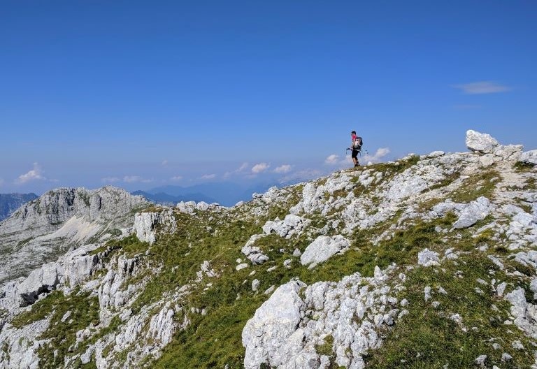
    In the immediate vicinity are the Škocjan Caves, among the most beautiful in the world. They are a UNESCO World Natural Heritage Site. The rather flat path will than take you to the foot of Nanos, where you will climb over 1000 m above sea level.


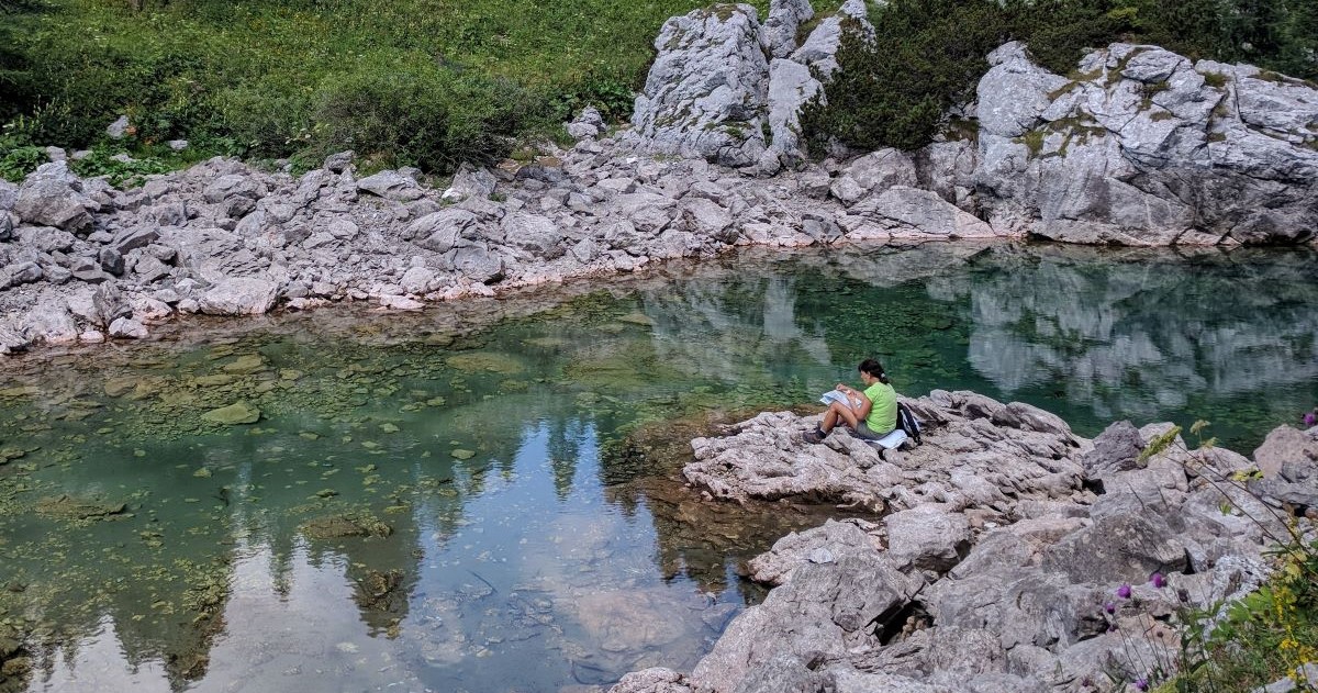
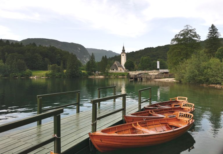
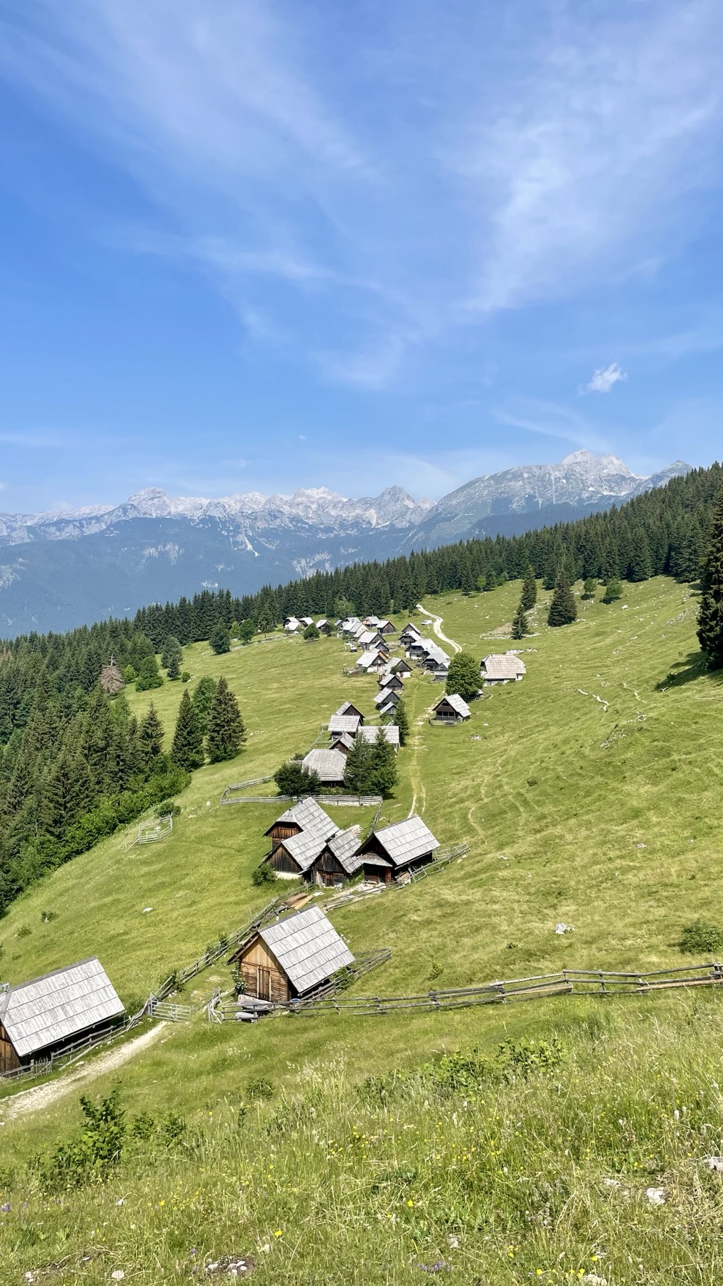
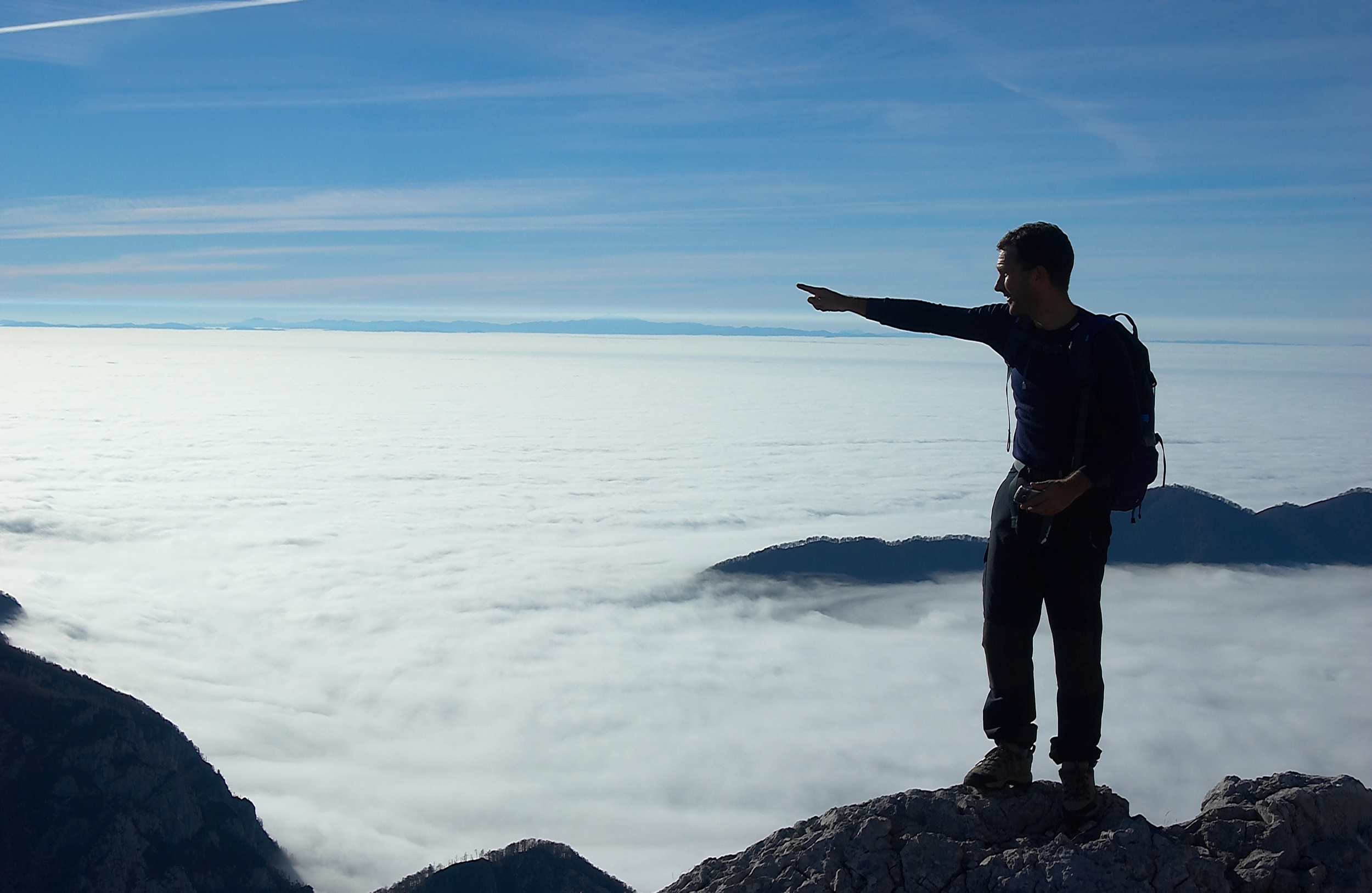
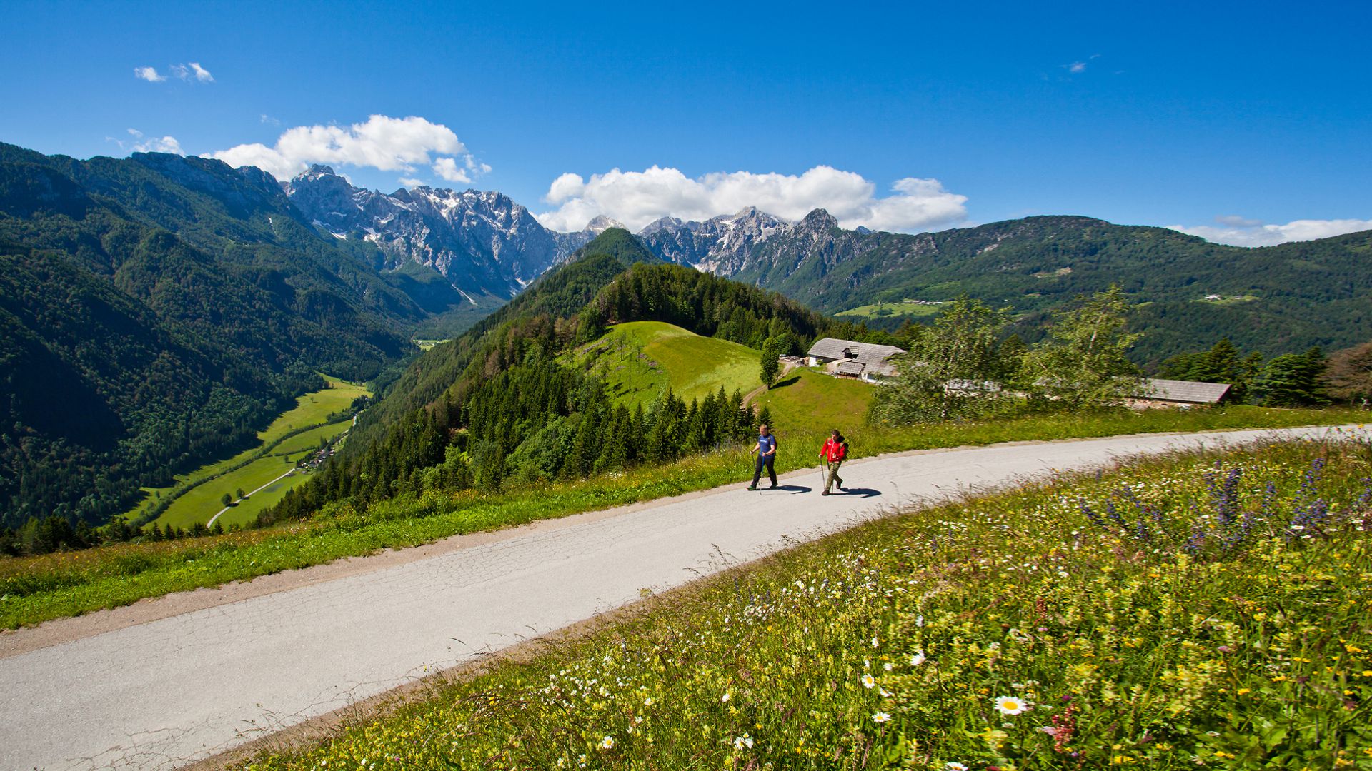
    The trail will take you through Idrija, all the way into the world of the Julian Alps and the Triglav National Park. From the altitude you will see Lake Bohinj and visit the beautiful Triglav Lakes.


    The trail continues along mountain paths over the Vršič Pass, from where it descends among the sparse larch trees towards the Tamar Valley. From the Tamar Valley, the trail will take you either further into Austria, or you can hike along the valley to Planica and end your journey here.